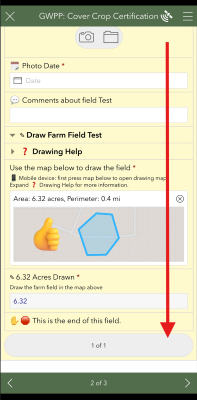
Internet Browser on 📱 Mobile Device or 💻 Desktop/Laptop Computer
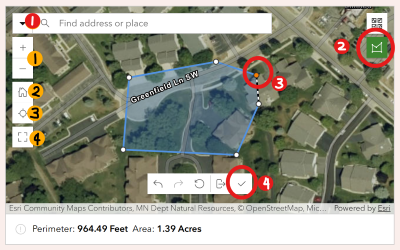
1. 🔎︎ Find the location by typing in the nearest address in the search then click suggestion or zoom to location
2. 👇Click the Area shape tool in the upper right corner
3. 👇Tap or Click in the map at each corner of the farm field
4. ✔️To complete shape, double click or click the check mark
5. ⬇️Zoom back down to the bottom and move to the next field or continue the form
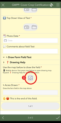
Survey123 App on 📱 Mobile Device or 💻 Desktop/Laptop Computer
1. 👇Press to Activate Map
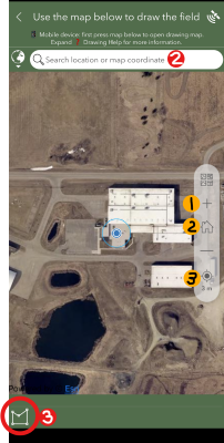
2. 🔎︎ Find the location by typing in the nearest address in the search then click suggestion or zoom to location
3. 👇Press Shape Tool in Lower Left Corner
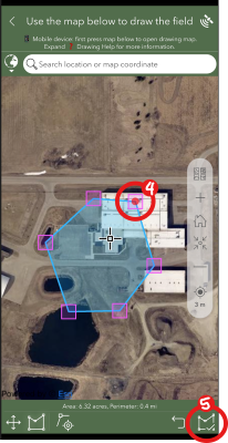
4. 👇Tap or Click in the map at each corner of the farm field
5. ✔️Click the check in the lower right corner
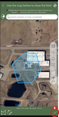
6. ✔️Confirm the shape and click the check again
7. ⬇️Zoom back down to the bottom and move to the next field or continue the form
Use additional tools highlighted in orange to help location the field:
1. ✚ Zoom in or ─ Zoom out
2. 🏠︎ Zoom out to Olmsted County
3. 𖦏 use device location (great if on site)
4. ⛶ Use Full Screen Mode
Internet Browser (Chrome, Edge, Safari)
Survey 123 App: